


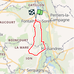


8.4 km | 10.7 km-effort


User


FREE GPS app for hiking
 SityTrail
IGN / Geographical institutes
SityTrail World
The world is yours!
Trail Walking of 8.2 km to be discovered at Normandy, Eure, Nassandres sur Risle. This trail is proposed by tracegps.
Circuit proposé par l’Office de Tourisme de Beaumont-le-Roger. Départ de l’Eglise de Fontaine la Soret. A voir sur le chemin : Eglise St Martin (XIe, XVIe, XIXe) de très beaux passages en forêt et en bordure d’étangs. A proximité : Château (XVIIIe) et étang de Fontaine-la-Soret, Prieuré de Malassis dit St Eloi (XIe, XIIe) Le dépliant reprenant l’ensemble des circuits est à votre disposition à l’office du Tourisme.


Walking

Walking
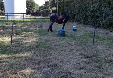
Horseback riding
Equestrian

Mountain bike

Walking

Walking
Walking